


 Trash & Recycling
 Online Payments
 City Documents
 Parks
Parks
 Traffic Court
 E-NEWS
 EXPLORE
 NEWS
NEWS
North Rodney Parham Bike Lanes
A bike-friendly route to the Arkansas River Trail has been out of reach for many Little Rock residents, especially those living in West Little Rock. This gap in connectivity encourages residents transport their bikes on/in their cars to get to the trail, increasing vehicular congestion on the road and parking demands on trailheads and decreasing overall ridership.
The City has expanded the width of N. Rodney Parham Rd. from Valley Club Circle to just short of Cantrell Rd. (approximately 2582 linear ft. of added bike lanes on both sides of the road), allowing 6 ft. wide bike lanes along this corridor (Picture 1). The Master Bike Plan called for bike lanes from Rocky Valley Dr. to Cantrell Rd. (Fig. 1). The modest increase of the scope of the project to include bike lanes from Rocky Valley Dr. to Valley Club Circle is a significant addition to this corridor. While Valley Club Circle is not proposed for sharrows on the Master Bike Plan, it is a common bike route (e.g. the Arkansas Bike Club rides Valley Club Circle to N. Rodney Parham every Thursday).
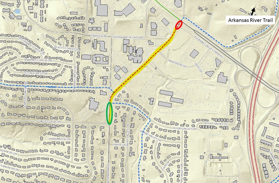
Figure 1. The Master Bike Plan called for bike lanes from Rocky Valley Dr. to Cantrell Rd. (dotted red line). The yellow highlight is where the bike lanes were installed. The City went above and beyond the Master Bike Plan to increase the bike lane corridor to the south (green circle) but did not extend the bike lanes all the way to Cantrell due to potentially conflicting future work on Cantrell by the Arkansas Highway and Transportation Department (red circle, see also below).
This project opens the Arkansas River Trail to much of West Little Rock (Fig. 2).
The City of Little Rock did not widen N. Rodney Parham (a City street) all the way to Cantrell (a State Highway) because the Arkansas Highway and Transportation Department (AHTD) will soon work on Cantrell in this area. AHTD has not yet shared with the City concept drawings for their planned Cantrell work; any (expensive) N. Rodney Parham width expansion in AHTD's Cantrell right-of-way done by the City may have needed to be undone in AHTD's project. The City therefore stopped N. Rodney Parham expansion in this section to accommodate AHTD's Cantrell project.
Figures 3-8 show the new bike lane facilities traveling north from Valley Club Circle to Cantrell. The northbound bike lane ends before the Cantrell intersection (Fig. 8). Signage in the bike lane and for cars will facilitate bike traffic to safely merge with vehicular traffic when the bike lane ends (Fig. 9). Figures 10-16 show the new bike lane facilities traveling south from Cantrell to Valley Club Circle. Note the traffic pattern approaching Pleasant Forest Dr. so that you are familiar with how to navigate it when riding (Fig. 14-15).
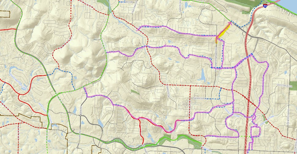
Figure 2. This relatively small project (yellow highlight) will connect the Arkansas River Trail to much of West Little Rock. Dotted blue lines are proposed sharrows on the Master Bike Plan. While not installed, these indicate streets that are relatively bike-friendly without the addition of bike lanes. Note all of West Little Rock connected to the Arkansas River Trail through the N. Rodney Parham bike lane, other installed bike lanes, and proposed sharrows (purpose highlight).
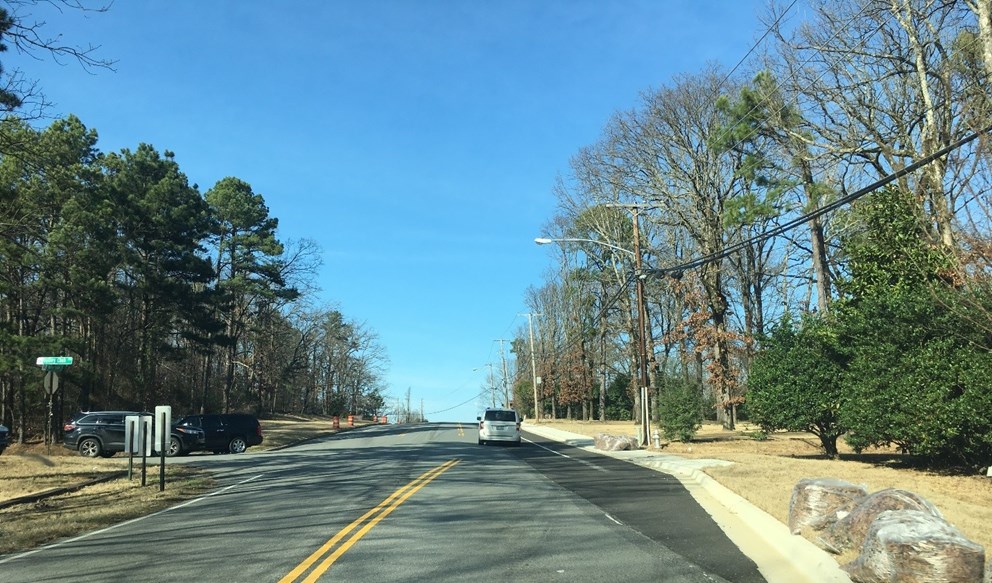
Figure 3. N. Rodney Parham Rd. widening and bike lanes start at Valley Club Circle (traveling north).

Figure 4. N. Rodney Parham and Rocky Valley Dr. (traveling north).
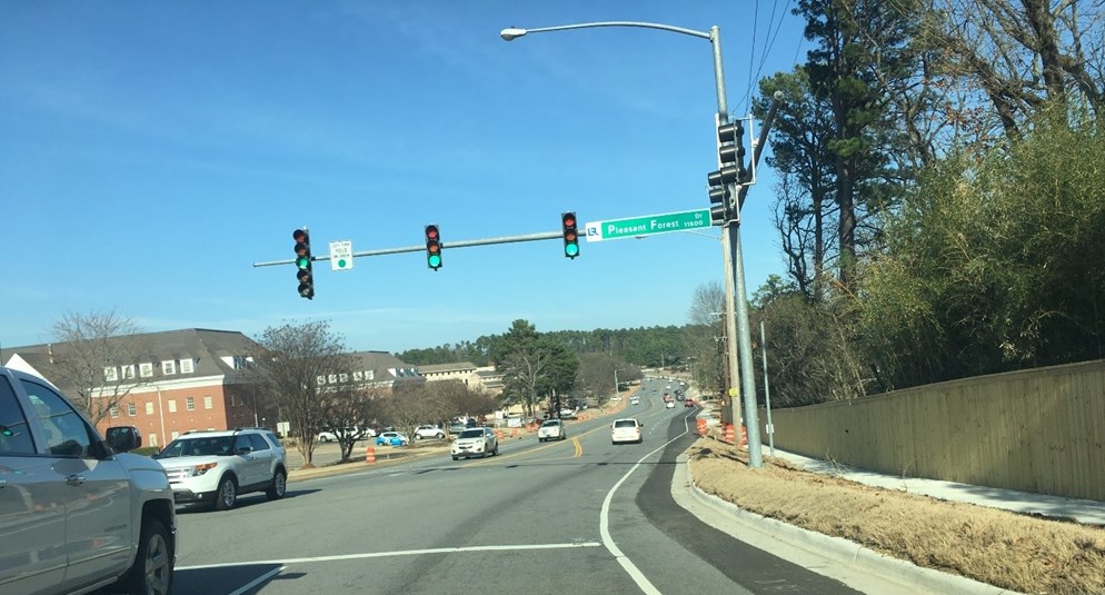
Figure 5. N. Rodney Parham and Pleasant Forest Dr. (traveling north).
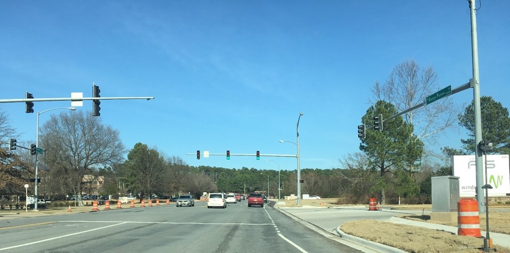
Figure 6. N. Rodney Parham and Systematics Rd. (traveling north).
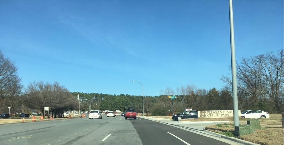
Figure 7. N. Rodney Parham and Anderson Rd. (traveling north).
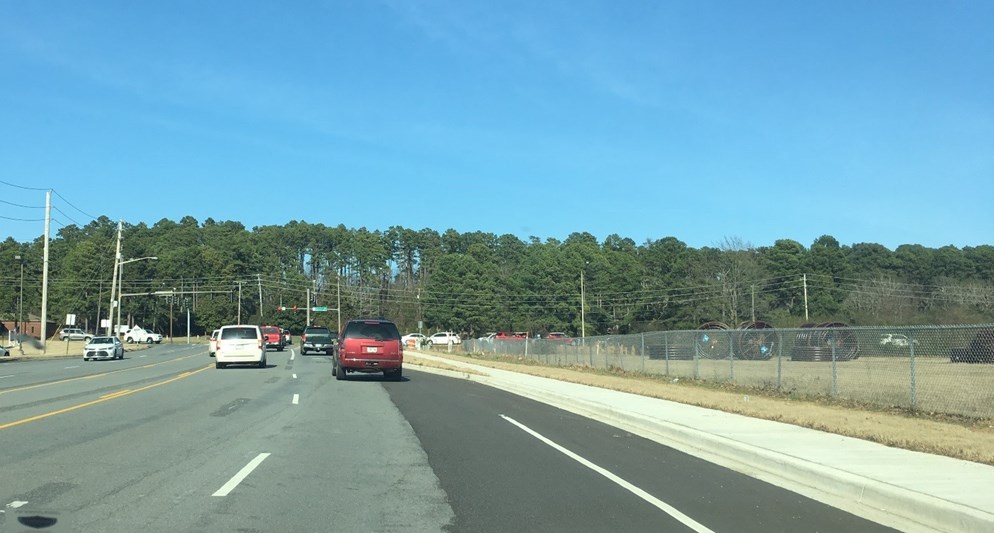
Figure 8. N. Rodney Parham approaching Cantrell (traveling north). The end of this bike lane will soon be dashed to indicate that bicycles will be merging from the bike lane into the vehicular travel lane in that dashed section. Signage on the pavement of the bike lane will clarify this need to merge for bicyclists and a sign will warn drivers that bikes are merging (see also Picture 9).
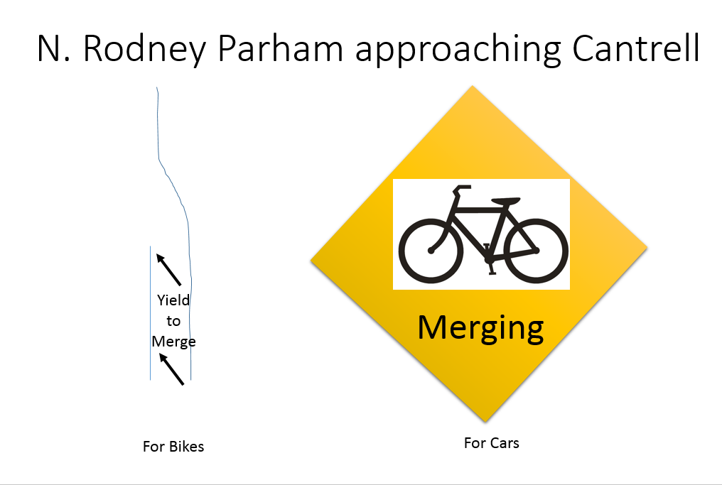
Figure 9. Pavement markings in the bike lane will warn riders that they will need to merge into the right vehicular traffic lane. A sign will warn drivers that bikes are merging into a vehicular traffic lane in this section.
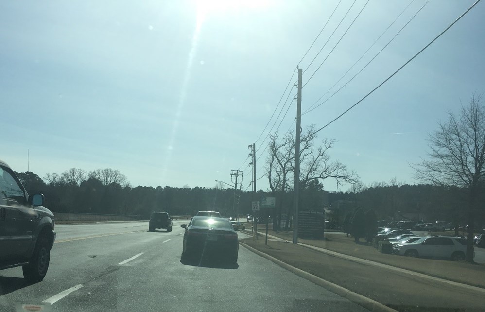
Figure 10. N. Rodney Parham just south of Cantrell (traveling south). Note that the bike lanes do not start immediately from the intersection of N. Rodney Parham and Cantrell.
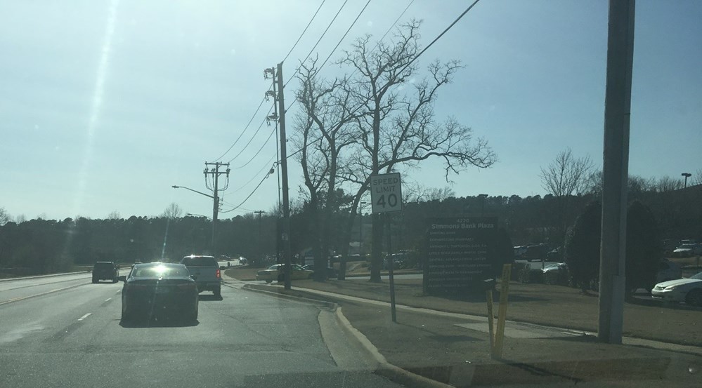
Figure 11. N. Rodney Parham south of Cantrell (traveling south). The road widens just north of Simmons Bank Plaza to accommodate a right turn lane into the plaza. This right turn lane is not the start of a bike lane; bike traffic should remain in the right travel lane.
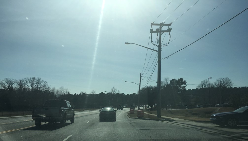
Figure 12. N. Rodney Parham at the Simmons Bank Plaza entrance (traveling south). The bike lane starts immediately south of the Simmons Bank Plaza entrance.
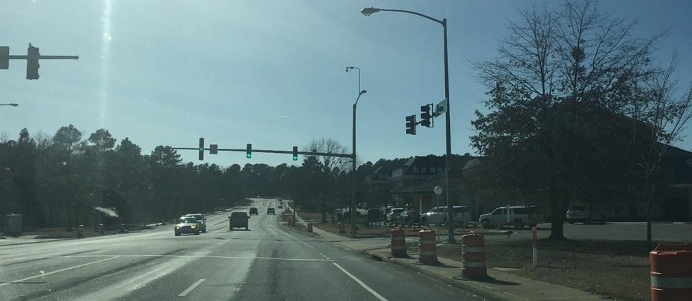
Figure 13. N. Rodney Parham at Systematics Rd. (traveling south).
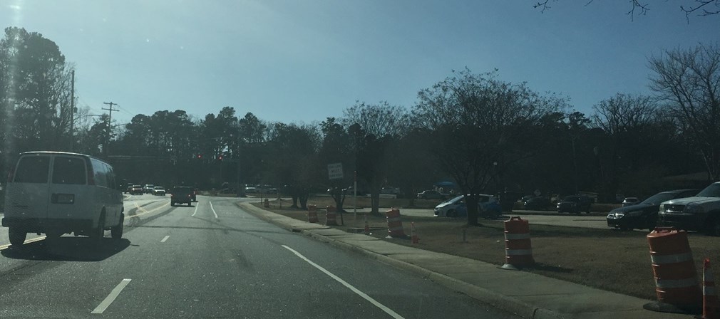
Figure 14. N. Rodney Parham approaching Pleasant Forest Dr. (traveling south). Note that the bike lane ends to accommodate a right turn lane at Pleasant Ridge and begins again to the left of the right turn lane (see Picture 15 below).
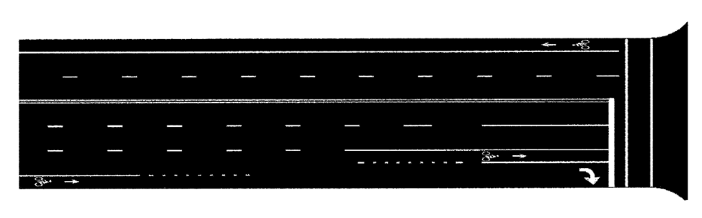
Figure 15. The N. Rodney Parham and Pleasant Forest Dr. intersection (traveling south) has a traffic pattern that may not be intuitive for bicyclists or drivers. In this intersection, a bicyclist wishing to turn right must yield to incoming vehicular traffic and then occupy the right turn lane. A bicyclist wishing to go straight must yield to vehicular traffic coming into the right turn lane then cross the right turn lane to occupy the bike lane left of the right turn lane (Figure from AASHTO Guide to Bicycle Facilities, 4th Edition).
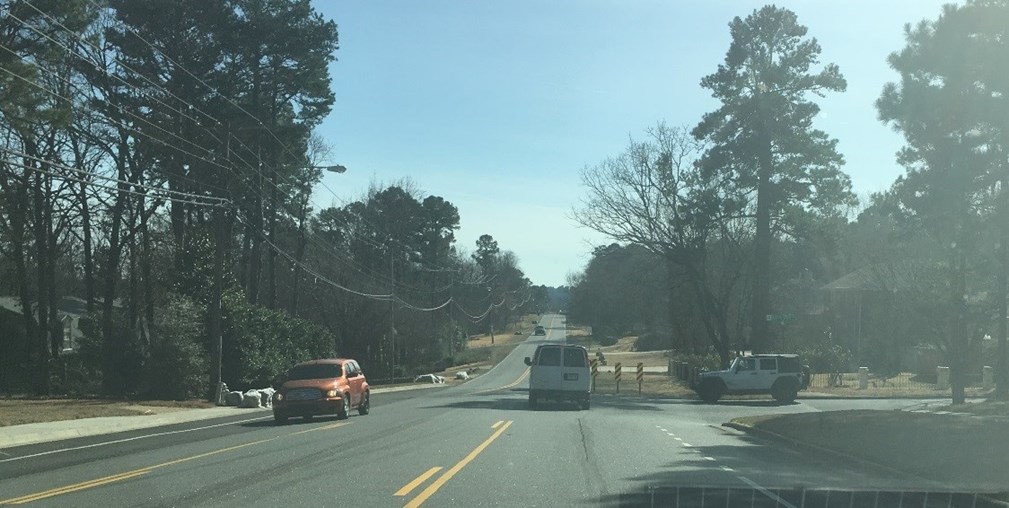
Figure 16. The N. Rodney Parham and Valley Club Circle (traveling south). The bike lanes end at Valley Club Circle. Bicycle traffic continuing on N. Rodney Parham Rd. must merge into the vehicular traffic lane (note the dashed bike at its terminus to indicate the merge). We intend to include signage similar to Picture 9 here as well.
