


 Trash & Recycling
 Online Payments
 City Documents
 Parks
Parks
 Traffic Court
 E-NEWS
 EXPLORE
 NEWS
NEWS
Arkansas River Trail - Medical Mile Connection
The City of Little Rock has received a $1.6 million Federal Lands Access Program (FLAP) grant to create a ramp connection between the bicycle and pedestrian bridge over the Union Pacific tracks just west of the Department of Arkansas Heritage Building to the Medical Mile. The grant will also buttress and repair the western terminus of the Medical Mile, which is currently falling into the Arkansas River. Together, the bridge, the ramp, and the riverbank stabilization/repair will complete a continuous off-street trail from the Clinton Bridge to the Dillard’s Data Center and will be a major step forward in closing the Arkansas River Trail Loop.
This ramp will be ~600 ft. long to allow the ~30 ft. climb from the Medical Mile to the east side of the BikePed Bridge at a 5% grade (Fig. 1). The buttressing and repair work to the Medical Mile will provide a necessary foundation for the ramp as well as preserve an at-grade connection to the proposed Central High Corridor. The Central High Corridor will be the first new construction of the Southwest Trail, a proposed 63-mile trail from Little Rock to Hot Springs.
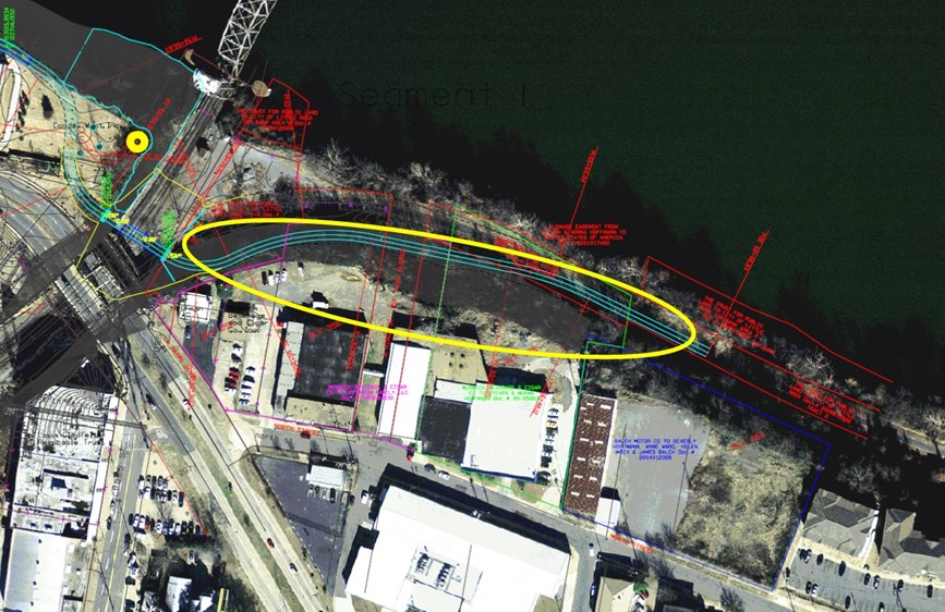
Figure 1. The ramp will extend from the BikePed bridge to the Medical Mile (yellow circle). Note the Arkansas River Trail route to the west of the BikePed bridge is still undetermined.
Why is the Medical Mile Connection Important?
The Connection will allow users of the Arkansas River Trail to travel a separated BikePed trail along the river (Fig. 2) rather than on a sidewalk and city streets from the end of the BikePed bridge to N. Gaines St. (Fig. 3). Without the ramp, a trail user traveling east would be routed onto a narrow sidewalk immediately adjacent to Cantrell/LaHarpe Arkansas State Highway 10 after crossing the BikePed bridge. LaHarpe is a busy street (28,000 vehicles per day) and vehicle speeds are fast, creating dangerous and stressful conditions for a recreational trail (Fig. 4A). Trail users would then be routed onto city streets from North St. to State St., to Garland St., to N. Gaines St. (Fig. 3).
With the ramp, a trail user traveling east would cross the BikePed bridge then walk or ride the ramp down to the Medical Mile along the Arkansas River (Fig. 4B). This would be by far more aesthetically pleasing, wayfinding would not be problematic for visitors and new trail users, and it would be completely off-road, providing accessibility for trail users who are unable or unwilling to use on-road facilities (e.g. parents with strollers or bike trailers, children learning to ride, etc.). This ramp has the potential to dramatically increase Arkansas River Trail use in this corridor by increasing the user groups that would use the facility and making the experience more pleasant.
Even though we did get the FLAP award and we will be building a ramp from the BikePed bridge to the Medical Mile, the Figure 3/4A route will be the Arkansas River Trail route after the trail is opened under the Broadway Bridge and after the BikePed Bridge is opened but before the Medical Mile Ramp is constructed. The City is looking for a way to widen the sidewalk along LaHarpe for the temporary purpose of accommodating the Arkansas River Trail during this transitional time and the permanent purpose of building a better connection between our on-street bike network and the trail.
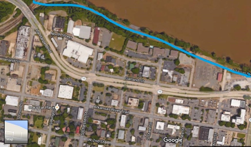
Figure 2. The Medical Mile ramp will allow the Arkansas River Trail to be completely off-street between the BikePed bridge and N. Gaines St.
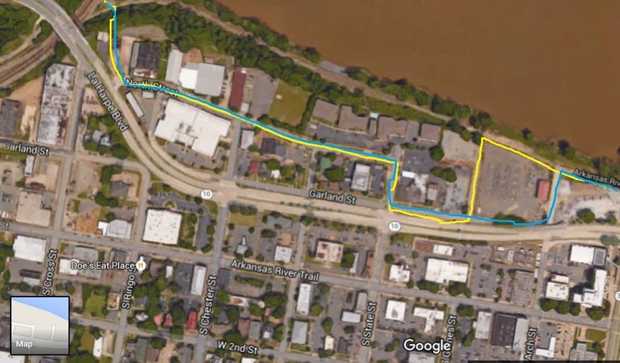
Figure 3. Without the FLAP grant that the City was just awarded, the Arkansas River Trail would have had to follow one of these two routes from the bridge to Arch St.
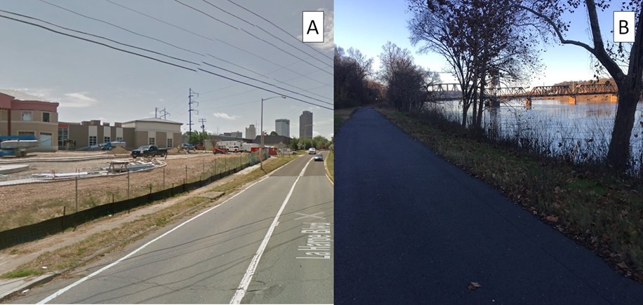
Figure 4. 4A) The sidewalk along LaHarpe represents part of the Arkansas River Trail route without the Medical Mile ramp. 4B) With the ramp, users will walk and ride along the scenic Arkansas River, safe from vehicular traffic.
