
Close the Loop
By far the worst and most infamous gap in the Arkansas River Trail is along Highway 10 immediately east of the Cantrell Bridge. Users must either ride in the highway or along a sidewalk (Fig. 1-2). Only the most stress-tolerant bicycle commuters use it (Fig. 4). The City of Little Rock and others have proposed to route the trail along the river behind Dillard’s Headquarters (Fig. 3), at-grade, in front of the building within Dillard’s, above-grade within Dillard’s (Fig. 4), along the highway, and behind the Episcopal School. We have not yet found a solution that is both safe for all-ages-and-abilities and acceptable to Dillard’s or the Episcopal School.
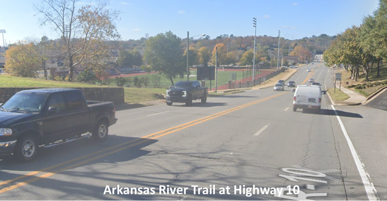
Figure 1. Current conditions of the official Arkansas River Trail route along Highway 10. Note how close the sidewalk ramp is to oncoming traffic.
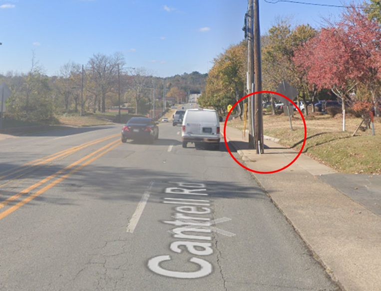
Figure 2. Telephone poles and signage in the current Arkansas River Trail alignment make navigation challenging.
Figure 3. Proposal for addressing the gap along the Arkansas River.
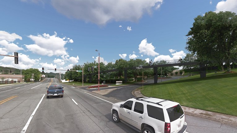
Figure 4. Bicycle Advocacy of Central Arkansas’s proposal of the Arkansas River Trail above the grade of Dillard’s entrance and exit ramps to avoid conflicts and create an all-ages-and-abilities corridor.
If a safe and comfortable all-ages-and-abilities alignment cannot be created along Highway 10 at this time, there is an alternative alignment that would create a safe, if indirect, connection in the short term and increase momentum to other high-priority projects (Fig. 5).
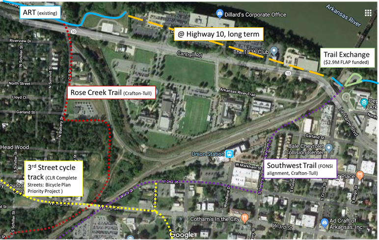
Figure 5. Together, projects surrounding the Highway 10 section of the Arkansas River Trail could create a safe and comfortable bypass of the more direct Highway 10 corridor.
Rose Creek Trail
The Capitol View/Stifft Station neighborhood has been working on the Rose Creek Trail for years. Their work with developer Ted Mullenix resulted in having a completely resolved ROW between the Arkansas River Trail and 3rd Street. The City has contracted with Crafton-Tull to determine the alignment.
3rd Street Cycle Track
A safe and comfortable bicycle facility between the Heights, Hillcrest, and Capitol View/Stifft Station would provide access to downtown Little Rock and, as such, is one of three CLR Complete Streets: Bicycle Plan Priority Projects (pg. 80-81). A road diet on this section of 3rd Street once seemed challenging, but is far more feasible now that there will be a road diet on Markham from Kavanaugh to Cedar (and perhaps beyond).
Southwest Trail / Central High Corridor
Pulaski, Garland, and Saline Counties and the City of Little Rock are in the process of creating a 63-mile trail connection between Hot Springs and Little Rock, the Southwest Trail, that will be a national attraction to Central Arkansas. The City of Little Rock is at least responsible for creating a trail connection between the Central High National Historic Site and the Arkansas River Trail (dubbed the “Central High Corridor”). The City of Little Rock has contracted with Crafton-Tull to create an alignment from the Arkansas River Trail to Garland Street and work with Union Pacific to get ROW.
Trail Exchange
In 2017 and 2020, the City of Little Rock was awarded $1.66M and $1.3M respectively to stabilize the river bank, create a ramp from the Arkansas River Trail terminus to the BikePed bridge over the Union Pacific tracks, and to create an exchange between the Arkansas River Trail and the Central High Corridor/Southwest Trail (Fig. 4).