
Existing Conditions
Kavanaugh Boulevard between Markham and Van Buren is typically a 40-42 ft. wide street with two lanes. It has a speed limit of 30 mph, but wide lanes (20-21 ft. wide west of Martin if no parked cars) encourage higher vehicular speeds traffic and are less safe for people driving, biking, or walking. Kavanaugh has 7.9K vehicles per day just south of Cantrell (outside the resurfacing zone, but the closest ArDOT estimate). Sidewalks are present throughout, but vary in width and condition. Separating Kavanaugh into five zones (Fig. 1), Zone 1 is a long hill and has fog lanes demarcating parking, Zone 2 is also a long hill east of Oak St. but does not have fog/parking lanes, Zone 3 has the Allsopp Park promenade curb extensions, narrowing Kavanaugh to 35 ft. in places, Zone 4 is the business district, and Zone 5 is designed much like Zone 2.
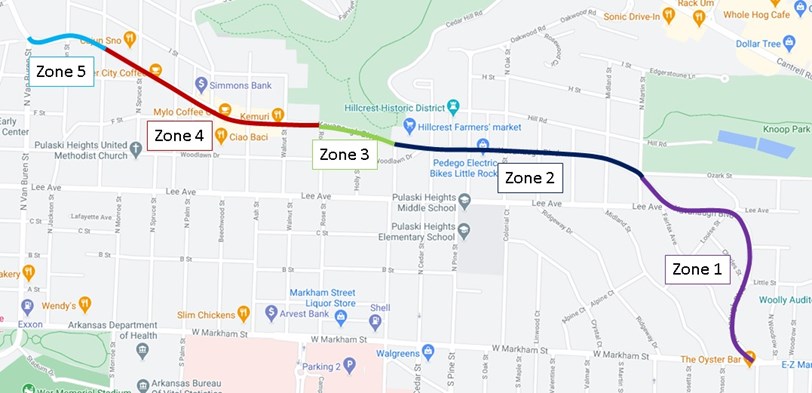
Figure 1. A map of the Kavanaugh current conditions, divided into five zones.
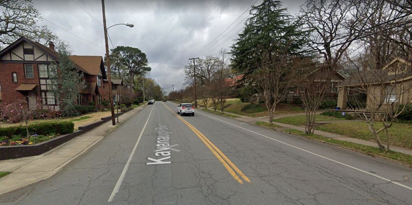
Figure 2. Streetview of Kavanaugh, looking west, from Louise (Zone 1).