Trash & Recycling
 Online Payments
 City Documents
 Parks
Parks
 Traffic Court
 E-NEWS
 EXPLORE
 NEWS
NEWS
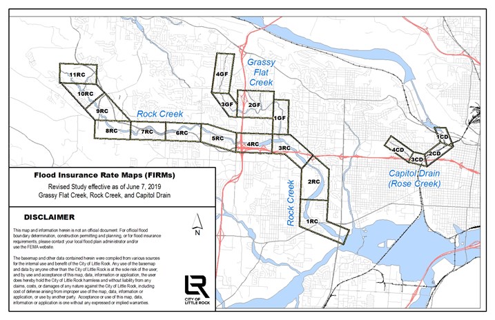
FIRM Special Study 2019
Flood Insurance Rate Maps SPECIAL STUDY 2019
Effective June 7, 2019
Note: These maps illustrate the changes in coverage from the previous accepted study.
FLOODPLAIN
1CD - 2CD - 3CD - 4CD (Capitol Drain)
1GF - 2GF - 3GF - 4GF (Grassy Flat)
1RC - 2RC - 3RC - 4RC - 5RC - 6RC - 7RC - 8RC - 9RC - 10RC - 11RC (Rock Creek)
FLOODWAY
1CD - 2CD - 3CD - 4CD (Capitol Drain)
1GF - 2GF - 3GF - 4GF (Grassy Flat)
1RC - 2RC - 3RC - 4RC - 5RC - 6RC - 7RC - 8RC - 9RC - 10RC - 11RC (Rock Creek)